
Dataja:Ireland location map.svg

Größe der PNG-Vorschau dieser SVG-Datei: 481 × 599 pikselow. Druge rozeznaśa: 192 × 240 pikselow | 385 × 480 pikselow | 616 × 768 pikselow | 822 × 1.024 pikselow | 1.643 × 2.048 pikselow | 1.450 × 1.807 pikselow.
Originalna dataja (dataja SVG, nominalnje: 1.450 × 1.807 piksele, wjelikosć dataje: 938 kB)
Zespominanje
| wopis |
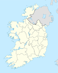
Deutsch: Positionskarte von Irland
Quadratische Plattkarte, N-S-Streckung 170 %. Geographische Begrenzung der Karte:
English: Location map of Ireland
Equirectangular projection, N/S stretching 170 %. Geographic limits of the map:
|
| Datum | 01-07-2008 |
| Žrědło | own work, using United States National Imagery and Mapping Agency data |
| Awtor | NordNordWest |
| Druge wersije toś teje dataje |
DerivativeVersions |


|
Diese Karte wurde in der Kartenwerkstatt erstellt oder verbessert. Auch du kannst dort Karten vorschlagen, die zu erstellen, verändern oder übersetzen sind.
|
Licencěrowanje
Ja, awtor tutoho dźěła, wozjewjam je z tym pod slědowacymi licencami:

|
Směće tutón dokument pod wuměnjenjemi licency GNU Free Documentation License, wersija 1.2 abo nowša wersija, wozjewjeneje wot załožby Free Software Foundation kopěrować, rozšěrjeć a/abo změnić; njejsu njezměnite wotrězki, njeje žadyn prědni a žadyn zadni wobalkowy tekst. Kopija licency je we wotrězku z titulom GNU Free Documentation License wobsahowana. |
Toś ta dataja jo pód licencu Creative Commons Attribution-Share Alike 3.0 Unported licencěrowana
- Smějoš:
- gromaźe wužywaś – źěło kopěrowaś, rozšyriś a dalej daś
- změšaś – aby źěło pśiměrił
- Pód slědujucymi wuměnjenjami:
- pśipokazanje – Musyš źěło pó wašni pśipokazaś, kótaruž awtor abo licencowaŕ jo pódał (ale nic pó wašni, až by se gódało, až wón tebje abo twójo wužywanje źěła schwalijo).
- źěliś – Jolic měnjaš, pśetworjaš toś to źěło abo na njo natwarjaš, móžoš gótowe źěło jano pód teju sameju licencu ako toś ta rozšyriś.
Móžoš licencu swójeje wólby wubraś.
Stawizny dataje
Tłoc na datum/cas aby tencasna wersija se lodowała.
| datum/cas | Pśeglědowy wobraz | rozměry | Wužywaŕ | Komentar | |
|---|---|---|---|---|---|
| něntejšny | 18. julija 2020, 08:45 | | 1.450x1.807 (938 kB) | Chipmunkdavis | Adding toggle to display pre-2014 boundaries, adjusting some code for names and shape |
| 11. julija 2020, 08:47 |  | 1.450x1.807 (908 kB) | Chipmunkdavis | Overhauling code, together with code from File:Galway City in Ireland.svg (itself derived from this file), to be both simpler and more easily editable. All islands are now grouped with their mainland county, and counties are grouped into provinces. Groups exist for traditional counties where divided. | |
| 12. septembra 2014, 14:08 |  | 1.450x1.807 (597 kB) | Ravenpuff | Retry that | |
| 12. septembra 2014, 13:57 |  | 1.450x1.807 (597 kB) | Ravenpuff | Merged North Tipperary and South Tiperrary, Limerick and County Limerick, Waterford and County Waterford (Local Government Reform Act 2014) | |
| 1. septembra 2009, 20:04 |  | 1.450x1.807 (598 kB) | NordNordWest | ||
| 25. awgusta 2008, 21:08 |  | 1.450x1.807 (599 kB) | NordNordWest | size correction | |
| 19. julija 2008, 20:13 |  | 483x602 (581 kB) | NordNordWest | ||
| 1. julija 2008, 16:13 |  | 483x602 (554 kB) | NordNordWest | {{Information |Description= {{de|Positionskarte von Irland}} Quadratische Plattkarte, N-S-Streckung 170 %. Geographische Begrenzung der Karte: * N: 55.6° N * S: 51.2° N * W: 11.0° W * O: 5.0° W {{en|Location map of [[:en:Ireland|Ireland |
Datajowe wužywanje
Slědujucy bok wótkazujo na toś tu dataju:
Globalne wužywanje datajow
Slědujuce druge wikije wužywaju toś ten wobraz:
- Wužywanje na af.wikipedia.org
- Wužywanje na am.wikipedia.org
- Wužywanje na ar.wikipedia.org
- Wužywanje na arz.wikipedia.org
- Wužywanje na ba.wikipedia.org
- Wužywanje na be-tarask.wikipedia.org
- Wužywanje na be.wikipedia.org
- Wužywanje na bg.wikipedia.org
Dalšne globalne wužywanje toś teje dataje pokazaś.