
Dataja:Crimea republic map.png

Wjelikosć toś togo pśeglěda: 800 × 531 pikselow. Drugej rozeznaśi: 320 × 212 pikselow | 640 × 425 pikselow | 1.031 × 684 pikselow.
Originalna dataja (1.031 × 684 pikselow, wjelikosć dataje: 65 kB, MIME-Typ: image/png)
Zespominanje
| wopis |
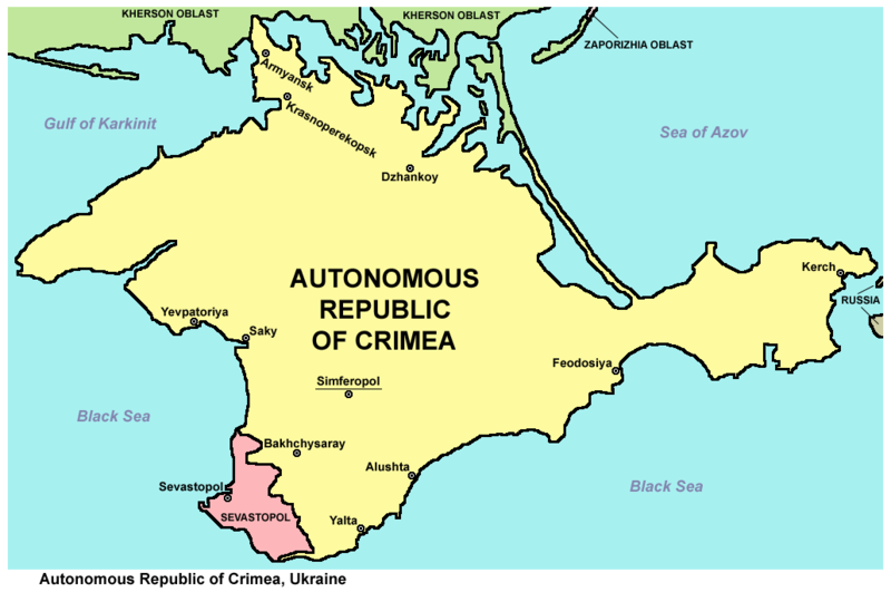
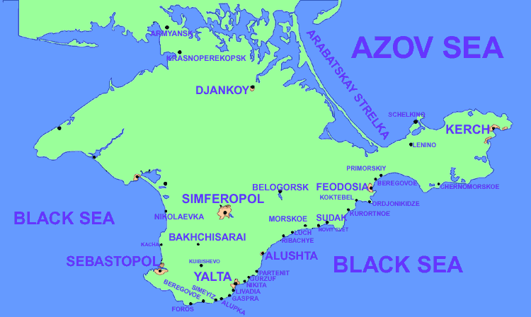
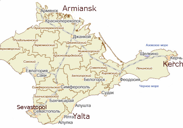
English: Map of the Autonomous Republic of Crimea and of Sevastopol, Ukraine.
Français : Carte de la République autonome de Crimée et de Sébastopol, Ukraine. Српски / srpski: Мапа Аутономне Републике Крим и Севастопоља, Украјина. |
| Datum | |
| Žrědło | Swójske źěło |
| Awtor | PANONIAN |
| Druge wersije toś teje dataje |
         |
Licencěrowanje
Ja, awtor tutoho dźěła, wozjewjam je z tym pod slědowacej licencu:
| Diese Datei wird unter der Creative-Commons-Lizenz „CC0 1.0 Verzicht auf das Copyright“ zur Verfügung gestellt. | |
| Die Person, die das Werk mit diesem Dokument verbunden hat, übergibt dieses weltweit der Gemeinfreiheit, indem sie alle Urheberrechte und damit verbundenen weiteren Rechte – im Rahmen der jeweils geltenden gesetzlichen Bestimmungen – aufgibt. Das Werk kann – selbst für kommerzielle Zwecke – kopiert, modifiziert und weiterverteilt werden, ohne hierfür um Erlaubnis bitten zu müssen.
|
References
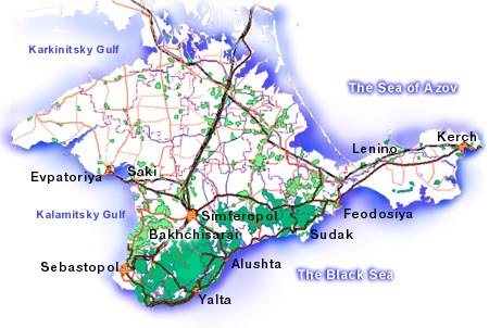
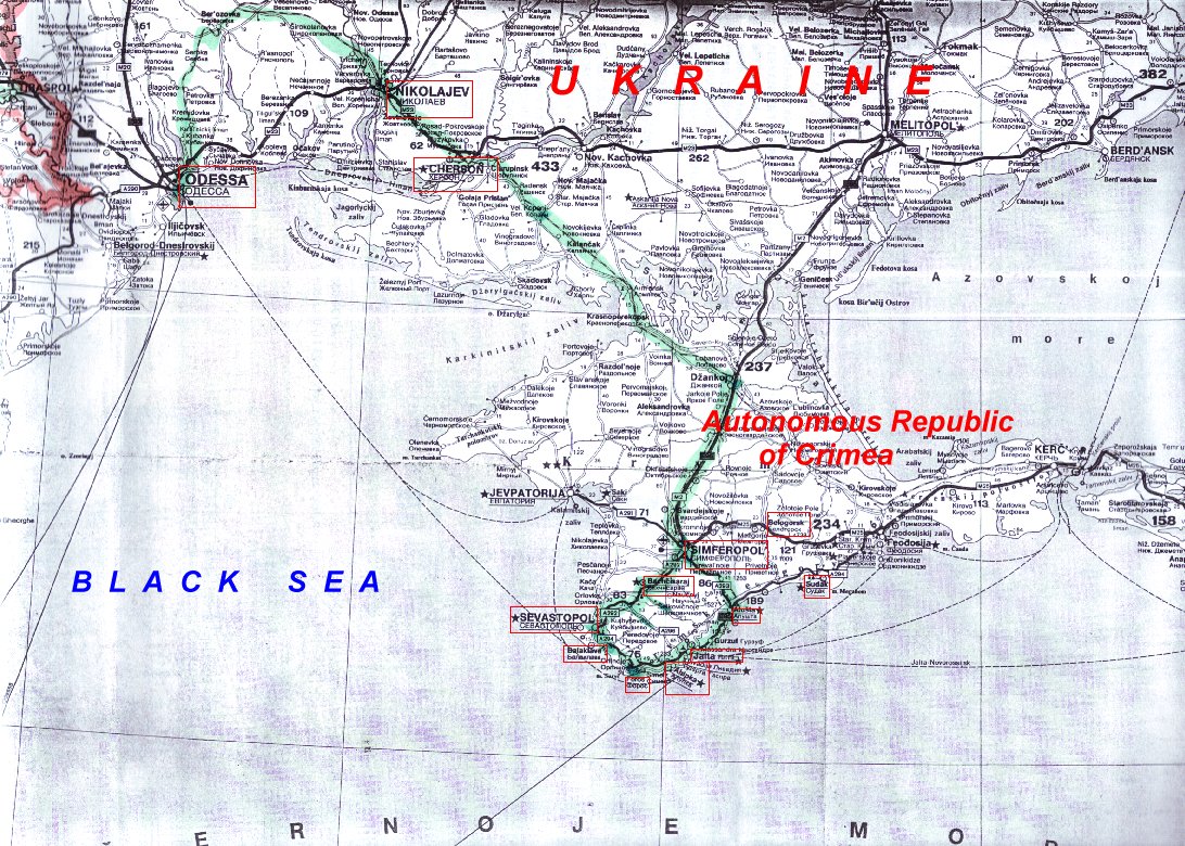
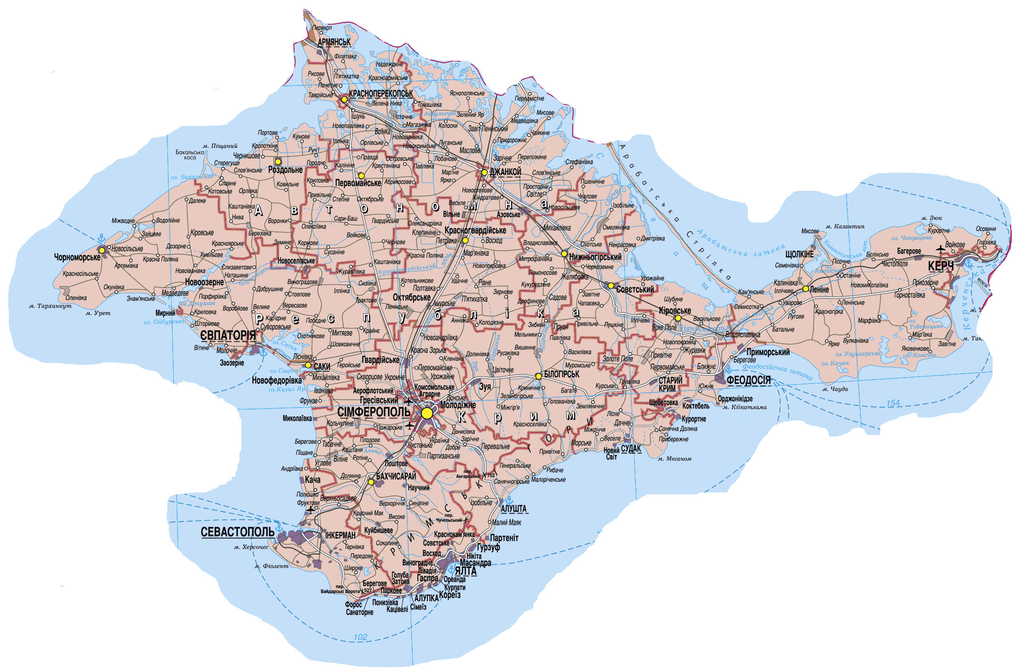
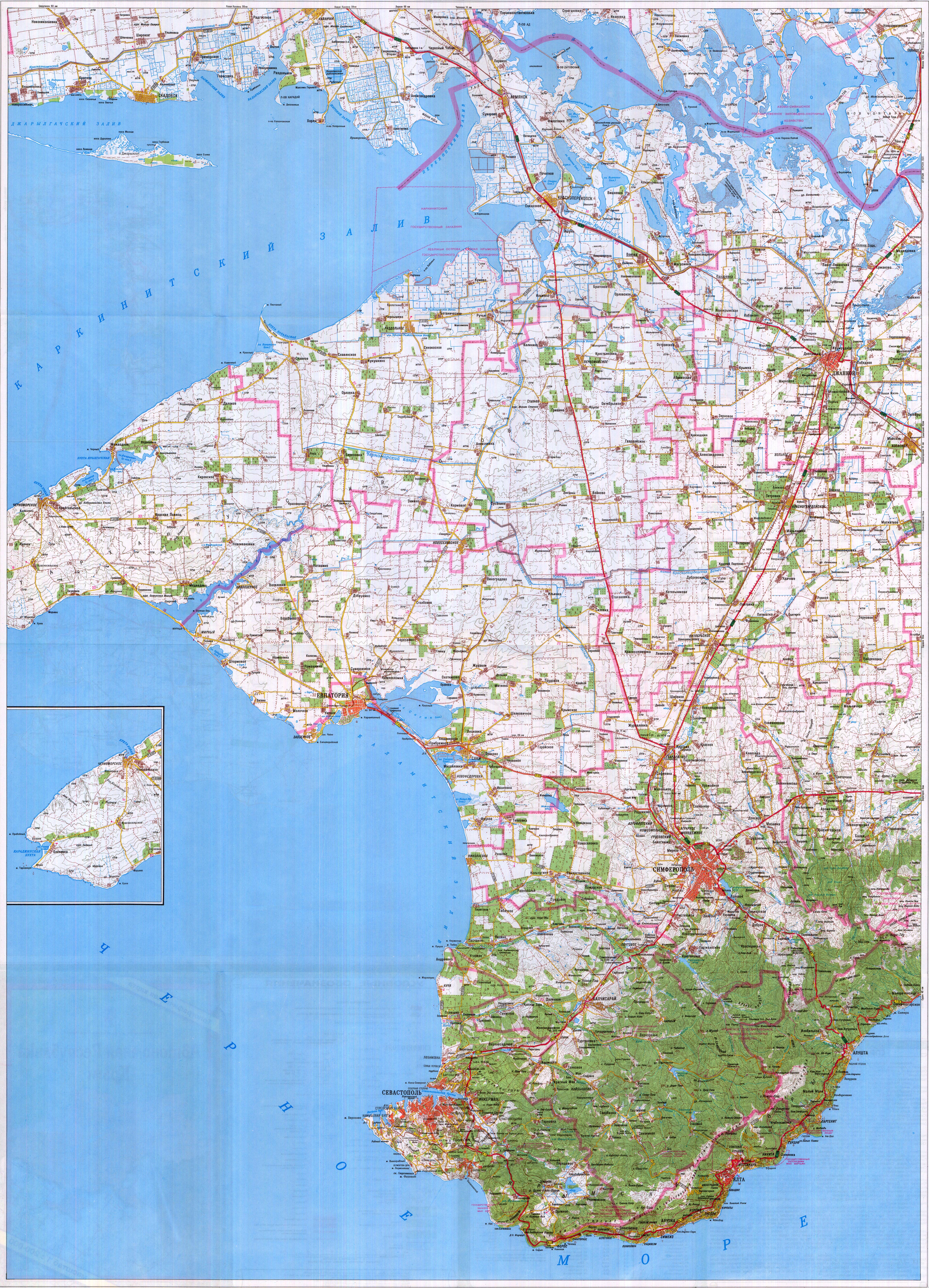
Maps from external links - entire Crimea:
- http://eurodialogue.org/files/fckeditor_files/crimea-map.gif
- http://www.lonelyplanet.com/maps/europe/ukraine/crimea/map_of_crimea.jpg
- http://www.rentmyflatinfeodosia.com/feodosia_guide/images/crimea_map2.jpg
- http://www.ukraine-travels.com/ukrainian-cities/images/crimea/crimea-map-s.jpg
- http://www.ua-business.com.ua/wp-content/uploads/2010/04/Canadian-investment-to-Crimea.jpg
- http://www.perekop.net/wp-content/uploads/crimea-map.gif
- http://mappery.com/maps/Crimea-Peninsula-Map.jpg
- http://www.globalsecurity.org/military/world/ukraine/images/crimea-map1.jpg
- http://www.riverofjoy-crimea.org/sitebuilder/images/Light_of_Crimea_TOPOGRAPHICAL_MAP_w_callouts-816x660.jpg
- http://www.mt.crimea.com/image/map_of_crimea.gif
- http://travel.kyiv.org/crimea/map/crimea_l.gif
- http://www.accesscrimea.com/images/map_crimeaprev.gif
- http://www.discover-ua.info/uploads/images/Crimea/map_of_crimea.gif
- http://www.nlminfo.org/userfiles/Image/map%20crimea0201.jpg archive copy at the Wayback Machine
- http://www.crimeamap.com/crimea_images/colorcrimeamap600x450-2.jpg archive copy at the Wayback Machine
- http://ruraltourism.com.ua/uploads/Image/oblast/eng/01.jpg
- http://www.oocities.org/new11world/crimea_map_en.jpg
- http://www.crimeahike.com/images/Crimea_Map_en.jpg archive copy at the Wayback Machine
- http://1.bp.blogspot.com/_-IladB6V24I/SPlo3CapnxI/AAAAAAAAB_E/OyjdgvtBpgU/s400/03.MapCrimea.Added..jpg
- http://weecheng.com/europe/bbs/crimea/crimea-map.jpg
- http://www.travel2crimea.com/image/common/map_of_crimea.png archive copy at the Wayback Machine
- http://www.mapofukraine.net/outdoor_activities/image/rockclimbing/crimea_climbing_map.gif
- http://novaonline.nvcc.edu/eli/evans/Photos/Russia/Yalta/Map.jpg
- http://www.ukrainebiz.com/maps/road_crimea.jpg
- http://coolhaus.de/misc/crimea-map.jpg
- http://russia-map.info/559885_BIG_0_0.jpg
- http://siriys-info.com/uploads/map/map1-crimea-full.jpg[toter Link]
- http://siriys-info.com/uploads/map/map3-crimea-full.gif archive copy at the Wayback Machine
- http://siriys-info.com/uploads/map/map2-crimea-full.gif[toter Link]
- http://vhodv.com/map/images/map_krym_b.jpg archive copy at the Wayback Machine
- http://our-travels.sumy.ua/ost/foto/Krym/135.jpg[toter Link]
- http://www.raster-maps.com/images/maps/rastr/ukraine/atlas/crimea_karta.jpg
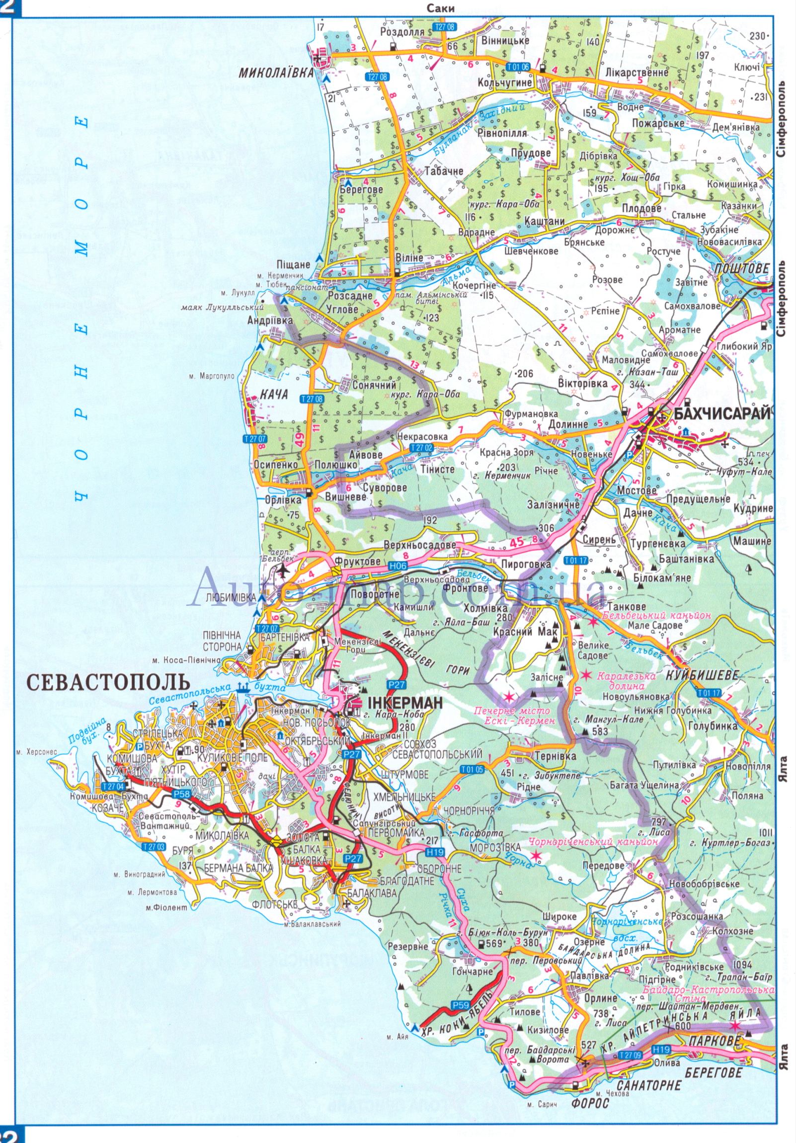
Maps from external links - Sevastopol municipality:
- http://siriys-info.com/uploads/map/map1-crimea-full.jpg[toter Link]
- http://novaonline.nvcc.edu/eli/evans/Photos/Russia/Yalta/Map.jpg
- http://auto-map.com.ua/379819_BIG_0_0.jpg
- http://www.justmaps.org/maps/images/ukraine/sevastopol-map2.jpg
- http://vhodv.com/map/images/map_krym_b.jpg archive copy at the Wayback Machine
- http://www.raster-maps.com/images/maps/rastr/topographical/ukraine_oblast/krym_1.jpg
- http://blogto4ka.ru/wp-content/uploads/otdyh-v-solnechnogorskom-krym.gif
- http://4.bp.blogspot.com/-oqx_mnOV1P0/TpShYOsfpSI/AAAAAAAAE3c/HYi-YZL7IqY/s1600/Krym+trasa.jpg archive copy at the Wayback Machine
- http://our-travels.sumy.ua/ost/foto/Krym/135.jpg[toter Link]
- http://www.raster-maps.com/images/maps/rastr/ukraine/atlas/crimea_karta.jpg
Largest cities and towns in Crimea:
- http://world-gazetteer.com/wg.php?x=&men=gcis&lng=en&des=wg&geo=-220&srt=npan&col=abcdefghinoq&msz=1500&geo=-3726[toter Link]
Stawizny dataje
Tłoc na datum/cas aby tencasna wersija se lodowała.
| datum/cas | Pśeglědowy wobraz | rozměry | Wužywaŕ | Komentar | |
|---|---|---|---|---|---|
| něntejšny | 19. měrca 2014, 22:27 | | 1.031x684 (65 kB) | PANONIAN | more detailed description |
| 19. měrca 2014, 16:24 |  | 1.031x684 (61 kB) | PANONIAN | added label "Ukraine". I will also upload another file which represents opposite view point | |
| 3. měrca 2014, 07:26 |  | 1.031x684 (61 kB) | PANONIAN | Reverted to version as of 09:53, 6 September 2012 - revert per talk, please upload your version under different name | |
| 2. měrca 2014, 23:32 |  | 1.013x650 (18 kB) | Ras67 | cropped, opt. | |
| 6. septembra 2012, 11:53 |  | 1.031x684 (61 kB) | PANONIAN | corrected Sevastopol border | |
| 30. awgusta 2012, 13:55 |  | 1.031x684 (60 kB) | PANONIAN | {{Information |Description=Map of the Autonomous Republic Crimea, Ukraine. |Source={{own}} |Date=2012 |Author= PANONIAN |Permission= |other_versions= }} |
Datajowe wužywanje
Slědujucy bok wótkazujo na toś tu dataju:
Globalne wužywanje datajow
Slědujuce druge wikije wužywaju toś ten wobraz:
- Wužywanje na af.wikipedia.org
- Wužywanje na an.wikipedia.org
- Wužywanje na arz.wikipedia.org
- Wužywanje na be-tarask.wikipedia.org
- Wužywanje na crh.wikipedia.org
- Wužywanje na cs.wikipedia.org
- Wužywanje na da.wikipedia.org
- Wužywanje na en.wikipedia.org
- Wužywanje na en.wikinews.org
- Wužywanje na es.wikipedia.org
- Wužywanje na et.wikipedia.org
- Wužywanje na fa.wikipedia.org
- Wužywanje na fi.wikipedia.org
- Wužywanje na fr.wikipedia.org
- Wužywanje na got.wikipedia.org
- Wužywanje na hi.wikipedia.org
- Wužywanje na hr.wikipedia.org
- Wužywanje na hsb.wikipedia.org
- Wužywanje na hy.wikipedia.org
- Wužywanje na hyw.wikipedia.org
- Wužywanje na io.wikipedia.org
- Wužywanje na is.wikipedia.org
- Wužywanje na it.wikipedia.org
- Wužywanje na ja.wikipedia.org
- Wužywanje na ko.wikipedia.org
- Wužywanje na lbe.wikipedia.org
- Wužywanje na ms.wikipedia.org
- Wužywanje na no.wikipedia.org
- Wužywanje na pnb.wikipedia.org
- Wužywanje na pt.wikipedia.org
- Wužywanje na ro.wikinews.org
- Wužywanje na sc.wikipedia.org
- Wužywanje na sh.wikipedia.org
- Wužywanje na sk.wikipedia.org
- Wužywanje na sl.wikipedia.org
- Wužywanje na sr.wikipedia.org
Dalšne globalne wužywanje toś teje dataje pokazaś.