Dataja:Barents sea map de.png

Seiteninhalte werden in anderen Sprachen nicht unterstützt.
Z Wikipedije

Originalna dataja(1.188 × 1.085 pikselow, wjelikosć dataje: 252 kB, MIME-Typ: image/png)

Toś ta dataja jo z Wikimedia Commons a dajo se pśez druge projekty wužywaś. Wopisanje na jeje boku datajowego wopisanja pokazujo se dołojce.

wopis
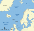
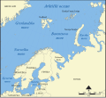
Deutsch: Diese Karte zeigt die Lage der Barentssee nördlich von Norwegen und Russland mit den umliegenden Meeren und Inseln in deutscher Beschriftung.
English: This map shows the location of the Barents Sea north of Russia and Norway, and the surrounding seas and islands, with German labels.
Datum (UTC)
Žrědło
Awtor
Druge wersije toś teje dataje

[wobźěłaś]

Norwegian Sea
Barents Sea


Dieses Bild wurde digital nachbearbeitet. Folgende Änderungen wurden vorgenommen: added German labels. Das Originalbild kann hier eingesehen werden: Barents sea map blank.png. Bearbeitet von Hämbörger.

Ja, awtor tutoho dźěła, wozjewjam je z tym pod slědowacej licencu:
GNU head Směće tutón dokument pod wuměnjenjemi licency GNU Free Documentation License, wersija 1.2 abo nowša wersija, wozjewjeneje wot załožby Free Software Foundation kopěrować, rozšěrjeć a/abo změnić; njejsu njezměnite wotrězki, njeje žadyn prědni a žadyn zadni wobalkowy tekst. Kopija licency je we wotrězku z titulom GNU Free Documentation License wobsahowana.
w:dsb:Creative Commons
pśipokazanje źěliś
Toś ta dataja jo pód licencu Creative Commons Attribution-Share Alike 3.0 Unported licencěrowana
Smějoš:
  • gromaźe wužywaś – źěło kopěrowaś, rozšyriś a dalej daś
  • změšaś – aby źěło pśiměrił
Pód slědujucymi wuměnjenjami:
  • pśipokazanje – Musyš źěło pó wašni pśipokazaś, kótaruž awtor abo licencowaŕ jo pódał (ale nic pó wašni, až by se gódało, až wón tebje abo twójo wužywanje źěła schwalijo).
  • źěliś – Jolic měnjaš, pśetworjaš toś to źěło abo na njo natwarjaš, móžoš gótowe źěło jano pód teju sameju licencu ako toś ta rozšyriś.
Tuta licencna marka je so tutej dataji jako dźěl licencneje aktualizacije přidała.

Originalny protokol nagraśow

This image is a derivative work of the following images:

  • File:Barents_sea_map_blank.png licensed with GFDL
    • 2006-02-28T22:27:52Z Historicair 1200x1098 (257777 Bytes) This map shows the location of the Barents Sea north of Russia and Norway, and the surrounding seas and islands. Created by NormanEinstein, November 25, 2005. Modified and blanked by ~~~~ {{GFDL-self}} [[Category:Maps of

Hochgeladen mit derivativeFX

Krótkowopisy

Dodaj jednolinkowy wopis tuteje dataje.

W tutej dataji zwobraznjene objekty

motiw górnoserbšćina

status awtorskich prawow górnoserbšćina

23. februara 2009

MIME-Typ nimšćina

image/png

Prüfsumme nimšćina

536b28bfcd325df3a7e71ac76d2dec5d4e80be60

Bestimmungsmethode nimšćina: SHA-1 nimšćina

Dateigröße nimšćina

258.065 Byte

wysokosć górnoserbšćina

1.085 Pixel

šěrokosć górnoserbšćina

1.188 Pixel

Stawizny dataje

Tłoc na datum/cas aby tencasna wersija se lodowała.

datum/casPśeglědowy wobrazrozměryWužywaŕKomentar
něntejšny10. decembra 2012, 04:52Pśeglědowy wobraz za wersiju wót 10. decembra 2012, 04:521.188x1.085 (252 kB)Ras67cropped
23. februara 2009, 15:50Pśeglědowy wobraz za wersiju wót 23. februara 2009, 15:501.200x1.098 (357 kB)Olaf Studtcorrected an error (the "Laptewsee" is somewhere else)
23. februara 2009, 15:24Pśeglědowy wobraz za wersiju wót 23. februara 2009, 15:241.200x1.098 (361 kB)Olaf Studt{{Information |Description={{de|Diese Karte zeigt die Lage der Barentssee nördlich von Norwegen und Russland mit den umliegenden Meeren und Inseln in deutscher Beschriftung.}} {{en|This map shows the location of the Barents Sea north of Russia and Norway

Slědujucy bok wótkazujo na toś tu dataju:

Globalne wužywanje datajow

Slědujuce druge wikije wužywaju toś ten wobraz: