
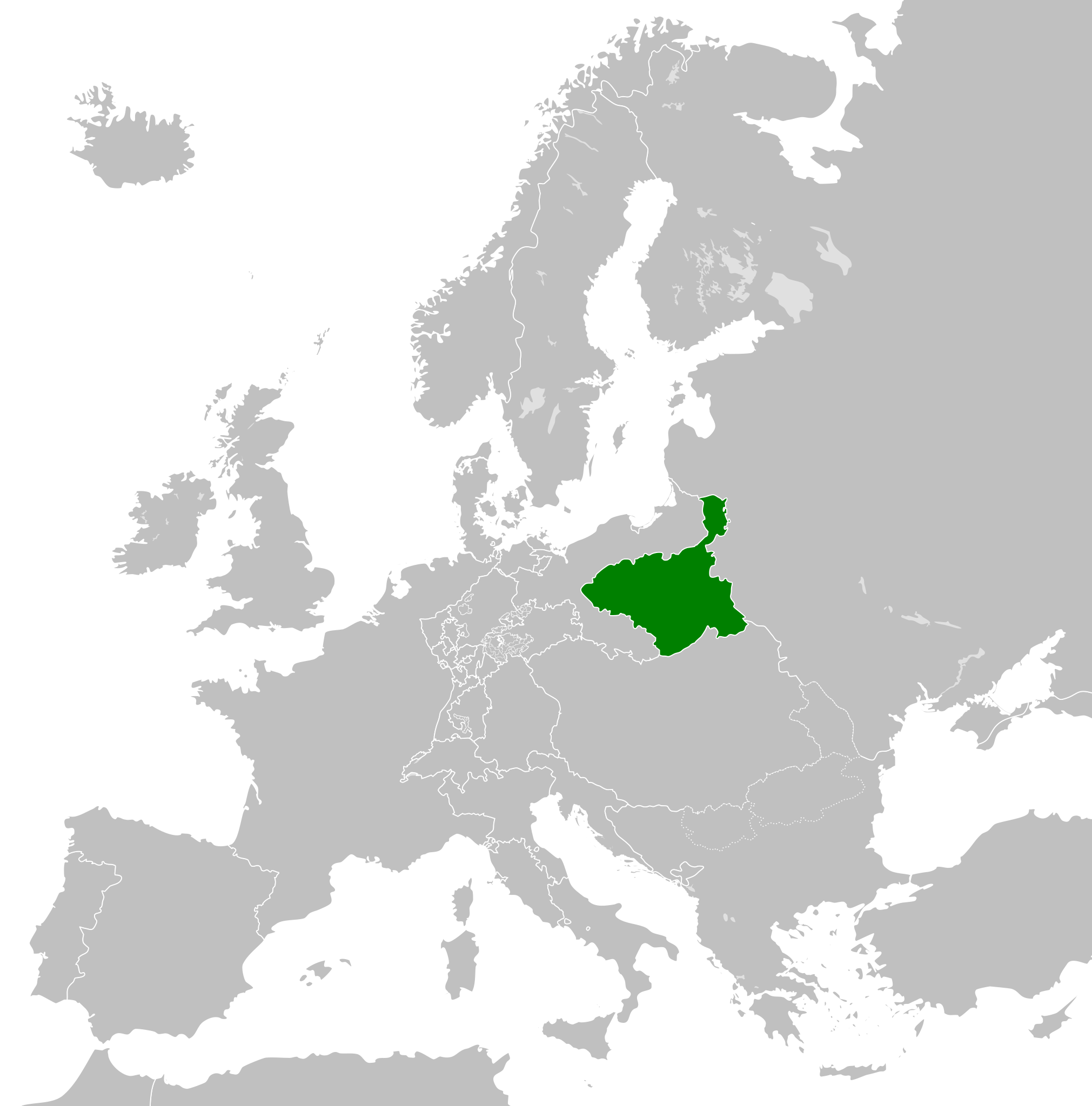
Dataja:Duchy of Warsaw (1812).svg

Größe der PNG-Vorschau dieser SVG-Datei: 450 × 456 pikselow. Druge rozeznaśa: 237 × 240 pikselow | 474 × 480 pikselow | 758 × 768 pikselow | 1.011 × 1.024 pikselow | 2.021 × 2.048 pikselow.
Originalna dataja (dataja SVG, nominalnje: 450 × 456 piksele, wjelikosć dataje: 585 kB)
Zespominanje


.svg)
.svg)
.svg)
.svg)
.svg)


.svg)
.svg)
.svg)


.png)
.png)


.svg)


.svg)

.svg)


.svg)
.svg)
.svg)
.svg)


.svg)
.png)


.svg)


.svg)
.svg)


.svg)


.svg)


.svg)
.svg)
.svg)
.svg)
.svg)
.svg)
.svg)
.svg)
_cropped.svg)
.svg)
.svg)
.svg)
.svg)
.svg)
.svg)
.svg)
.svg)
.svg)
.svg)
.svg)
.svg)
.svg)
.svg)
.svg)
.svg)
.svg)
.svg)
.svg)
.svg)
.svg)
.svg)
.svg)
.svg)
.svg)
.svg)
.svg)
.svg)
.svg)
.svg)
.svg)
.svg)
.svg)
.svg)
.svg)
.svg)
.svg)
.svg)
.svg)
.svg)
.svg)
.svg)
.svg)
.svg)
.svg)
Stawizny dataje
Tłoc na datum/cas aby tencasna wersija se lodowała.
| datum/cas | Pśeglědowy wobraz | rozměry | Wužywaŕ | Komentar | |
|---|---|---|---|---|---|
| něntejšny | 5. oktobra 2013, 17:05 | | 450x456 (585 kB) | TRAJAN 117 | Updated |
| 24. nowembra 2012, 09:34 |  | 450x456 (449 kB) | TRAJAN 117 | {{Information |Description ={{en|1=The Duchy of Warsaw in 1812.}} |Source ={{own}} {{AttribSVG|First French Empire 1812.svg|Alphathon}} |Author =TRAJAN 117 {{created with Inkscape}} |Date =2012-11-24 |Pe... |
Datajowe wužywanje
Slědujucy bok wótkazujo na toś tu dataju:
Globalne wužywanje datajow
Slědujuce druge wikije wužywaju toś ten wobraz:
- Wužywanje na ar.wikipedia.org
- Wužywanje na ast.wikipedia.org
- Wužywanje na azb.wikipedia.org
- Wužywanje na az.wikipedia.org
- Wužywanje na ba.wikipedia.org
- Wužywanje na bg.wikipedia.org
- Wužywanje na cs.wikipedia.org
- Wužywanje na de.wikipedia.org
- Wužywanje na el.wikipedia.org
- Wužywanje na en.wikipedia.org
- Wužywanje na es.wikipedia.org
- Wužywanje na eu.wikipedia.org
- Wužywanje na fa.wikipedia.org
- Wužywanje na fi.wikipedia.org
- Wužywanje na fr.wikipedia.org
- Wužywanje na he.wikipedia.org
- Wužywanje na hy.wikipedia.org
- Wužywanje na id.wikipedia.org
- Wužywanje na it.wikipedia.org
- Wužywanje na ja.wikipedia.org
- Wužywanje na ko.wikipedia.org
- Wužywanje na mt.wikipedia.org
- Wužywanje na pl.wikipedia.org
- Wužywanje na pt.wikipedia.org
- Wužywanje na ru.wikipedia.org
- Wužywanje na sh.wikipedia.org
- Wužywanje na simple.wikipedia.org
- Wužywanje na sk.wikipedia.org
- Wužywanje na th.wikipedia.org
- Wužywanje na tr.wikipedia.org
- Wužywanje na uk.wikipedia.org
- Wužywanje na www.wikidata.org
- Wužywanje na zh-yue.wikipedia.org
- Wužywanje na zh.wikipedia.org
.svg)