
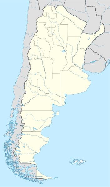
Dataja:Argentina location map.svg

Größe der PNG-Vorschau dieser SVG-Datei: 352 × 599 pikselow. Druge rozeznaśa: 141 × 240 pikselow | 282 × 480 pikselow | 451 × 768 pikselow | 602 × 1.024 pikselow | 1.204 × 2.048 pikselow | 1.418 × 2.412 pikselow.
Originalna dataja (dataja SVG, nominalnje: 1.418 × 2.412 piksele, wjelikosć dataje: 1,03 MB)
Zespominanje
.svg)
.svg)

|
Diese Karte wurde in der Kartenwerkstatt erstellt oder verbessert. Auch du kannst dort Karten vorschlagen, die zu erstellen, verändern oder übersetzen sind.
|
Licencěrowanje
Ja, awtor tutoho dźěła, wozjewjam je z tym pod slědowacymi licencami:

|
Směće tutón dokument pod wuměnjenjemi licency GNU Free Documentation License, wersija 1.2 abo nowša wersija, wozjewjeneje wot załožby Free Software Foundation kopěrować, rozšěrjeć a/abo změnić; njejsu njezměnite wotrězki, njeje žadyn prědni a žadyn zadni wobalkowy tekst. Kopija licency je we wotrězku z titulom GNU Free Documentation License wobsahowana. |
Toś ta dataja jo pód licencu Creative Commons Attribution-Share Alike 3.0 Unported licencěrowana
- Smějoš:
- gromaźe wužywaś – źěło kopěrowaś, rozšyriś a dalej daś
- změšaś – aby źěło pśiměrił
- Pód slědujucymi wuměnjenjami:
- pśipokazanje – Musyš źěło pó wašni pśipokazaś, kótaruž awtor abo licencowaŕ jo pódał (ale nic pó wašni, až by se gódało, až wón tebje abo twójo wužywanje źěła schwalijo).
- źěliś – Jolic měnjaš, pśetworjaš toś to źěło abo na njo natwarjaš, móžoš gótowe źěło jano pód teju sameju licencu ako toś ta rozšyriś.
Móžoš licencu swójeje wólby wubraś.
Stawizny dataje
Tłoc na datum/cas aby tencasna wersija se lodowała.
| datum/cas | Pśeglědowy wobraz | rozměry | Wužywaŕ | Komentar | |
|---|---|---|---|---|---|
| něntejšny | 11. awgusta 2022, 17:26 | | 1.418x2.412 (1,03 MB) | Janitoalevic | Reverted to version as of 02:18, 25 May 2021 (UTC) |
| 9. maja 2022, 02:27 |  | 1.418x2.412 (1,51 MB) | Buttons0603 | Reverted to version as of 20:33, 29 January 2021 (UTC) see below | |
| 25. maja 2021, 04:18 |  | 1.418x2.412 (1,03 MB) | MinervaAustral | Reverted to version as of 03:37, 24 November 2018 (UTC) | |
| 29. januara 2021, 22:33 |  | 1.418x2.412 (1,51 MB) | Buttons0603 | Reverted to version as of 13:13, 23 November 2018 (UTC) There is already a version with the Falklands in white at File:Argentina location map (+Falkland).svg for when such a map is needed. | |
| 24. nowembra 2018, 05:37 |  | 1.418x2.412 (1,03 MB) | Cacen Gymraeg | Reverted to version as of 01:43, 6 November 2017 (UTC). Added claim territories (neutral point of view) | |
| 23. nowembra 2018, 15:13 |  | 1.418x2.412 (1,51 MB) | Mr. James Dimsey | Reverted to version as of 23:25, 9 October 2015 (UTC) | |
| 6. nowembra 2017, 03:43 |  | 1.418x2.412 (1,03 MB) | Janitoalevic | Added Fontana and Plata Lake. | |
| 6. nowembra 2017, 03:37 |  | 1.418x2.412 (1,02 MB) | Janitoalevic | Fixed provincial and international borders. | |
| 25. měrca 2016, 23:36 |  | 1.418x2.412 (997 kB) | Janitoalevic | Added all the Disputed Territories | |
| 21. měrca 2016, 21:00 |  | 1.418x2.412 (994 kB) | Gustavo Girardelli | Detalles. |
.svg)
Datajowe wužywanje
Slědujucej 2 boka wótkazujotej na toś tu dataju:
Globalne wužywanje datajow
Slědujuce druge wikije wužywaju toś ten wobraz:
- Wužywanje na af.wikipedia.org
- Comodoro Rivadavia
- Mar del Plata
- Bariloche
- La Plata
- Villa General Belgrano
- FIFA Sokker-Wêreldbekertoernooi in 1978
- Balcarce
- Sarmiento
- Sjabloon:Liggingkaart Argentinië
- Monserrat, Buenos Aires
- Aconcagua
- Ojos del Salado
- Los Toldos
- Coloradorivier (Argentinië)
- Rawson
- Ministro Pistarini Internasionale Lughawe
- Wužywanje na an.wikipedia.org
- Wužywanje na ar.wikipedia.org
- Wužywanje na ast.wikipedia.org
- Buenos Aires
- Abbott
- Agote (Buenos Aires)
- La Plata
- Partido de La Plata
- Abasto (La Plata)
- Ángel Etcheverry
- Arturo Seguí
- City Bell
- Joaquín Gorina
- José Hernández (Buenos Aires)
- Manuel B. Gonnet
- Ringuelet
- Tolosa (Buenos Aires)
- Villa Elvira
- El Peligro (La Plata)
- San Carlos (Buenos Aires)
- Ríu de la Plata
- Mendoza (Arxentina)
- Costa de Reyes
- Santa Cruz (Catamarca)
- Las Tejas
Dalšne globalne wužywanje toś teje dataje pokazaś.