
Dataja:Antarctica relief location map.jpg

Wjelikosć toś togo pśeglěda: 600 × 600 pikselow. Druge rozeznaśa: 240 × 240 pikselow | 480 × 480 pikselow | 768 × 768 pikselow | 1.024 × 1.024 pikselow | 1.493 × 1.493 pikselow.
Originalna dataja (1.493 × 1.493 pikselow, wjelikosć dataje: 459 kB, MIME-Typ: image/jpeg)
Zespominanje
| wopis |
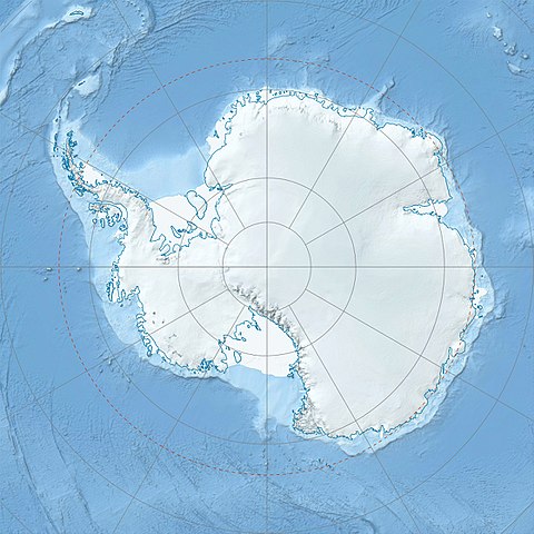
Deutsch: Physische Positionskarte Antarktis, Mittabstandstreue Azimutalprojektion
English: Physical Location map Antarctica, Azimuthal equidistant projection
|
| Datum | |
| Žrědło |
Swójske źěło
|
| Awtor | Alexrk2 |
| Druge wersije toś teje dataje |
|

Derivative works


|
Diese Karte wurde in der Kartenwerkstatt erstellt oder verbessert. Auch du kannst dort Karten vorschlagen, die zu erstellen, verändern oder übersetzen sind.
|
Licencěrowanje
Ja, awtor tutoho dźěła, wozjewjam je z tym pod slědowacej licencu:
Toś ta dataja jo pód licencu Creative Commons Attribution-Share Alike 3.0 Unported licencěrowana
- Smějoš:
- gromaźe wužywaś – źěło kopěrowaś, rozšyriś a dalej daś
- změšaś – aby źěło pśiměrił
- Pód slědujucymi wuměnjenjami:
- pśipokazanje – Musyš źěło pó wašni pśipokazaś, kótaruž awtor abo licencowaŕ jo pódał (ale nic pó wašni, až by se gódało, až wón tebje abo twójo wužywanje źěła schwalijo).
- źěliś – Jolic měnjaš, pśetworjaš toś to źěło abo na njo natwarjaš, móžoš gótowe źěło jano pód teju sameju licencu ako toś ta rozšyriś.
Stawizny dataje
Tłoc na datum/cas aby tencasna wersija se lodowała.
| datum/cas | Pśeglědowy wobraz | rozměry | Wužywaŕ | Komentar | |
|---|---|---|---|---|---|
| něntejšny | 26. julija 2017, 09:52 | | 1.493x1.493 (459 kB) | Amga | Reverted to version as of 16:03, 3 May 2011 (UTC). This is used in location maps, so don't rotate it! |
| 26. julija 2017, 02:00 |  | 1.488x1.493 (458 kB) | SteinsplitterBot | Bot: Image rotated by 90° | |
| 3. maja 2011, 18:03 |  | 1.493x1.493 (459 kB) | Alexrk2 | light blue hypso colors | |
| 21. februara 2010, 23:24 |  | 1.500x1.500 (818 kB) | Alexrk2 | == Summary == {{Information |Description= {{de|Physische Positionskarte Antarktis, Mittabstandstreue Azimutalprojektion}} {{en|Physical Location map Antarctica, Azimuthal equidistant projection}} * Longitude of central |
Datajowe wužywanje
Slědujucy bok wótkazujo na toś tu dataju:
Globalne wužywanje datajow
Slědujuce druge wikije wužywaju toś ten wobraz:
- Wužywanje na af.wikipedia.org
- Wužywanje na ar.wikipedia.org
- Wužywanje na arz.wikipedia.org
- Wužywanje na ast.wikipedia.org
- Wužywanje na az.wikipedia.org
- Şablon:Yer xəritəsi Antarktida
- Antarktik yarımadası
- Şablon:Yer xəritəsi Antarktida (fiziki)
- Antarktik boğazı
- Jerlaş boğazı
- Bransfild boğazı
- Lemeir boğazı
- Vostok gölü
- Friksel gölü
- Mak-Medro boğazı
- Veddell dənizi
- Birlik dənizi
- Riser-Larsen dənizi
- Kosmonavtlar dənizi
- Mouson dənizi
- Dürvil dənizi
- Somov dənizi
- Kral VII Haakon dənizi
- Deyvis dənizi
- Lazarev dənizi
- Bellinshauzen dənizi
- Amundsen dənizi
- Ross dənizi
- Skotia dənizi
- Mouson yarımadası
- Hat Point yarımadası
- I Aleksandr Torpağı
- Berkner
- Ross adası
- Erebus vulkanı
- Saypl
- Terston
- Karney
- Ruzvelt adası (Antarktida)
- Sifre burnu
- Cənubi Şetland adaları
- Cənubi Orkney adaları
- Koroneyşen
Dalšne globalne wužywanje toś teje dataje pokazaś.