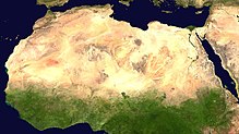
Dataja:Africa satellite plane.jpg

Wjelikosć toś togo pśeglěda: 570 × 600 pikselow. Druge rozeznaśa: 228 × 240 pikselow | 456 × 480 pikselow | 730 × 768 pikselow | 973 × 1.024 pikselow | 1.947 × 2.048 pikselow | 8.460 × 8.900 pikselow.
Originalna dataja (8.460 × 8.900 pikselow, wjelikosć dataje: 7,34 MB, MIME-Typ: image/jpeg)
Stawizny dataje
Tłoc na datum/cas aby tencasna wersija se lodowała.
| datum/cas | Pśeglědowy wobraz | rozměry | Wužywaŕ | Komentar | |
|---|---|---|---|---|---|
| něntejšny | 28. měrca 2005, 02:46 |  | 8.460x8.900 (7,34 MB) | Dbenbenn | original high-resolution version, cropped land_shallow_topo_west.tif at 8460x8900+19400+6200 |
| 13. nowembra 2004, 23:08 |  | 741x800 (113 kB) | Bjarki S |
Datajowe wužywanje
Slědujucy bok wótkazujo na toś tu dataju:
Globalne wužywanje datajow
Slědujuce druge wikije wužywaju toś ten wobraz:
- Wužywanje na ace.wikipedia.org
- Wužywanje na af.wikipedia.org
- Wužywanje na als.wikipedia.org
- Wužywanje na ar.wikipedia.org
- Wužywanje na ar.wikinews.org
- Wužywanje na ast.wikipedia.org
- Wužywanje na azb.wikipedia.org
- Wužywanje na az.wikipedia.org
- Wužywanje na az.wikiquote.org
- Wužywanje na ba.wikipedia.org
- Wužywanje na be.wikipedia.org
- Wužywanje na bm.wikipedia.org
- Wužywanje na ca.wikiquote.org
- Wužywanje na cdo.wikipedia.org
- Wužywanje na co.wikipedia.org
- Wužywanje na cv.wikipedia.org
- Wužywanje na da.wikipedia.org
- Wužywanje na de.wikipedia.org
- Oldowan
- CFA-Franc-Zone
- Fußball in Südafrika
- Portal:Afrika
- Wikipedia:Archiv/Qualitätsoffensive/Afrika
- Wikipedia:WikiProjekt Afrika
- Wikipedia Diskussion:WikiProjekt Afrika
- Uganda Olympic Committee
- Wikipedia:WikiProjekt Sudan
- Portal:Afrika/Unsere besten Artikel
- Wikipedia:WikiProjekt Äthiopien
- Portal:Gambia
- Fußball in Äthiopien
- Wikipedia:WikiProjekt Sudan/Verwandte
- Portal:Afrika/Register
- Benutzer:Vorlage/Herkunftsvorlagen
- Portal:Hip-Hop
- Portal:Hip-Hop/Hip-Hop nach Ländern
- Namibia National Olympic Committee
- Fußball
- Benutzer:Heiteck
- Benutzer:Vorlage/aus Afrika
- Gambia National Olympic Committee
- Portal:Nigeria
- Fußball in Lesotho
- Fußball in Burkina Faso
Dalšne globalne wužywanje toś teje dataje pokazaś.


