
Dataja:Aerial view of Nauru.jpg
Wjelikosć toś togo pśeglěda: 800 × 587 pikselow. Druge rozeznaśa: 320 × 235 pikselow | 640 × 469 pikselow | 1.024 × 751 pikselow | 1.280 × 938 pikselow | 1.600 × 1.173 pikselow.
Originalna dataja (1.600 × 1.173 pikselow, wjelikosć dataje: 545 kB, MIME-Typ: image/jpeg)
Zespominanje
| wopis |
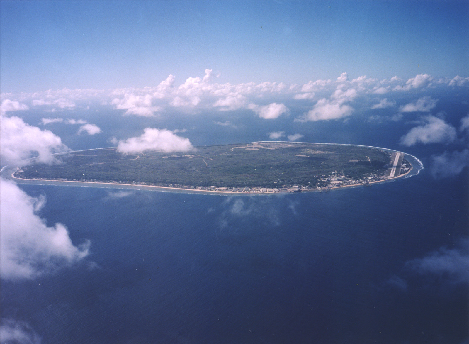
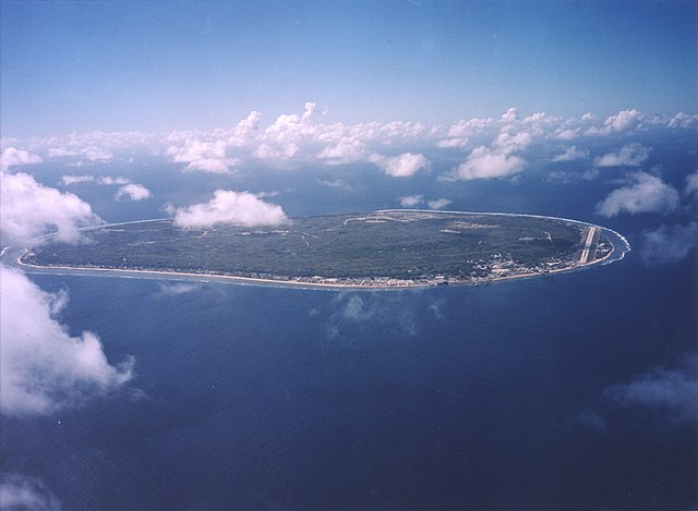
English: A limestone karst on Nauru Island as a result of the over-mining of phosphate. |
| Datum | |
| Žrědło | https://www.flickr.com/photos/armgov/4708951747/ |
| Awtor | U.S. Department of Energy's Atmospheric Radiation Measurement Program |
Licencěrowanje
Diese Photo wurde vom Atmospheric Radiation Measurement Programm angefertigt.
Auf der Seite des ARM wird angegeben:
|
Stawizny dataje
Tłoc na datum/cas aby tencasna wersija se lodowała.
| datum/cas | Pśeglědowy wobraz | rozměry | Wužywaŕ | Komentar | |
|---|---|---|---|---|---|
| něntejšny | 29. apryla 2023, 00:53 | | 1.600x1.173 (545 kB) | Auguel | Cropped 1 % vertically using CropTool with lossless mode. |
| 3. apryla 2007, 04:13 |  | 1.600x1.187 (401 kB) | Indolences | A limestone karst on Nauru Island as a result of the over-mining of phosphate. ''Courtesy: U.S. Department of Energy's Atmospheric Radiation Measurement Program.'' Source: [http://images.arm.gov/armimages.nsf/by+id/TENG-5JGSKP] (http://www.arm.gov/) {{ |
Datajowe wužywanje
Slědujucy bok wótkazujo na toś tu dataju:
Globalne wužywanje datajow
Slědujuce druge wikije wužywaju toś ten wobraz:
- Wužywanje na ar.wikipedia.org
- Wužywanje na as.wikipedia.org
- Wužywanje na bg.wikipedia.org
- Wužywanje na de.wikipedia.org
- Wužywanje na en.wikipedia.org
- Wužywanje na en.wikiversity.org
- Wužywanje na es.wikipedia.org
- Wužywanje na fr.wikipedia.org
- Wužywanje na fr.wiktionary.org
- Wužywanje na he.wikivoyage.org
- Wužywanje na hsb.wikipedia.org
- Wužywanje na hu.wikipedia.org
- Wužywanje na hy.wikipedia.org
- Wužywanje na id.wikipedia.org
- Wužywanje na incubator.wikimedia.org
- Wužywanje na lv.wikipedia.org
- Wužywanje na ms.wikipedia.org
- Wužywanje na na.wikipedia.org
- Wužywanje na nl.wikivoyage.org
- Wužywanje na pl.wikipedia.org
- Wužywanje na pt.wikivoyage.org
- Wužywanje na ru.wikipedia.org
- Wužywanje na ru.wikivoyage.org
- Wužywanje na simple.wikipedia.org
- Wužywanje na si.wikipedia.org
- Wužywanje na ta.wikipedia.org
- Wužywanje na test.wikipedia.org
- Wužywanje na th.wikipedia.org
- Wužywanje na tr.wikipedia.org
- Wužywanje na uk.wikipedia.org
- Wužywanje na vec.wikipedia.org
- Wužywanje na vi.wikipedia.org
- Wužywanje na vi.wikivoyage.org