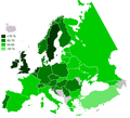
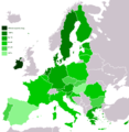
Dataja:Knowledge English EU map.png

Wjelikosć toś togo pśeglěda: 658 × 599 pikselow. Druge rozeznaśa: 264 × 240 pikselow | 527 × 480 pikselow | 843 × 768 pikselow | 1.124 × 1.024 pikselow | 2.151 × 1.959 pikselow.
Originalna dataja (2.151 × 1.959 pikselow, wjelikosć dataje: 1,08 MB, MIME-Typ: image/png)
Stawizny dataje
Tłoc na datum/cas aby tencasna wersija se lodowała.
| datum/cas | Pśeglědowy wobraz | rozměry | Wužywaŕ | Komentar | |
|---|---|---|---|---|---|
| něntejšny | 29. awgusta 2022, 16:38 |  | 2.151x1.959 (1,08 MB) | Рагин1987 | Extended map |
| 11. měrca 2022, 10:12 |  | 1.218x1.245 (81 kB) | LauritzT | Reverted to version as of 15:59, 19 March 2021 (UTC): The description states the image should include "... some other European states" | |
| 22. měrca 2021, 10:10 |  | 1.218x1.245 (78 kB) | Crashed greek | Update 2019 map for brexit | |
| 22. měrca 2021, 10:04 |  | 1.218x1.245 (90 kB) | Crashed greek | Update for brexit | |
| 19. měrca 2021, 17:59 |  | 1.218x1.245 (81 kB) | Jirka.h23 | Update 2019. | |
| 19. měrca 2021, 11:04 |  | 1.218x1.245 (90 kB) | Crashed greek | Update for brexit | |
| 28. junija 2017, 14:15 |  | 1.218x1.245 (82 kB) | Jirka.h23 | Update from Eurobarometer - Europeans and their Languages 2012. | |
| 4. měrca 2011, 22:56 |  | 1.218x1.245 (77 kB) | Aaker | Reverted to version as of 09:57, 13 August 2010 it's a candidate country and it participated in the survey | |
| 6. oktobra 2010, 16:59 |  | 1.218x1.245 (98 kB) | Rokerismoravee | Turkey is not EU | |
| 13. awgusta 2010, 11:57 |  | 1.218x1.245 (77 kB) | RoseAphro | Reverted to version as of 11:13, 2 January 2009 See Discussion |
Datajowe wužywanje
Slědujucy bok wótkazujo na toś tu dataju:
Globalne wužywanje datajow
Slědujuce druge wikije wužywaju toś ten wobraz:
- Wužywanje na ast.wikipedia.org
- Wužywanje na beta.wikiversity.org
- Wužywanje na bs.wikipedia.org
- Wužywanje na ca.wikipedia.org
- Wužywanje na ceb.wikipedia.org
- Wužywanje na cs.wikipedia.org
- Wužywanje na el.wikipedia.org
- Wužywanje na en.wikipedia.org
- Wužywanje na en.wikiversity.org
- Wužywanje na en.wikivoyage.org
- Wužywanje na eo.wikipedia.org
- Wužywanje na es.wikipedia.org
- Wužywanje na eu.wikipedia.org
- Wužywanje na fr.wikipedia.org
- Wužywanje na ga.wikipedia.org
- Wužywanje na gl.wikipedia.org
- Wužywanje na hr.wikipedia.org
- Wužywanje na io.wikipedia.org
- Wužywanje na ja.wikipedia.org
- Wužywanje na ku.wikipedia.org
- Wužywanje na lv.wikipedia.org
- Wužywanje na mk.wikipedia.org
- Wužywanje na nl.wikipedia.org
- Wužywanje na pa.wikipedia.org
- Wužywanje na ro.wikipedia.org
- Wužywanje na sk.wikipedia.org
- Wužywanje na sv.wikiversity.org
- Wužywanje na uk.wikipedia.org
- Wužywanje na www.wikidata.org


